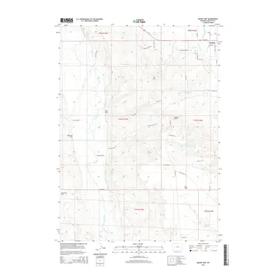
2015 Map of Mount Airy
USGS Topo · Published 2015About this map
The town of Pinedale sits at the northeastern edge of this Wyoming landscape, where the New Fork River and Duck Cr provide vital water sources in an arid region. The terrain is defined by dramatic elevation changes, notably Mt Airy and the expansive plateau known as The Mesa. This area is marked by a complex system of water management, including Basin Reservoir, Mesa Reservoir Number 2, and Desert Reservoir Number 2, highlighting the importance of irrigation and water storage for the surrounding ranching and range lands.
Find a feature on this map
42 named features on this map. Tap any name to fly to it.
Don’t see what you’re looking for? This feature index may not catch every label — zoom into the map to look around manually.
Map Details
Editions of this 2015 Mount Airy Map
This is the sole edition of this map. No revisions or reprints were ever made.
Other maps of this area

1939 · Big Piney
USGS Topo · 1:125,000

1942 · Big Piney
USGS Topo · 1:125,000

1955 · Preston
USGS Topo · 1:250,000

1955 · Lander
USGS Topo · 1:250,000

1958 · Lander
USGS Topo · 1:250,000

1958 · Preston
USGS Topo · 1:250,000

1961 · Lander
USGS Topo · 1:250,000

1962 · Preston
USGS Topo · 1:250,000

1964 · Two Buttes Reservoir
USGS Topo · 1:24,000

1964 · Mount Airy
USGS Topo · 1:24,000