
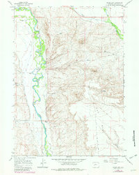
1964 Map of Mount Airy
USGS Topo · Published 1968About this map
The Green River carves a complex, braided path through this high plains landscape of Sublette County, defining the western edge of a region dominated by ranching and emerging energy extraction. Traditional cattle operations such as Grubbing Hoe Ranch, H Bar C Ranch, and Sommers Ranch are positioned near the water's edge, utilizing an intricate network of irrigation including the Green River Supply Canal, Soap Ditch, and Luman Ditch. To the east, the terrain rises sharply toward Mount Airy and the broad plateau of The Mesa, where the land-use shifts toward resource management as evidenced by Gas Wells and several livestock watering sources like Basin Res and Mesa Res No 1. The presence of the Mount Airy Drift Fence across the high ground illustrates the historic management of open-range grazing in this section of the upper Green River Basin.
Find a feature on this map
32 named features on this map. Tap any name to fly to it.
Don’t see what you’re looking for? This feature index may not catch every label — zoom into the map to look around manually.
Map Details
Editions of this 1964 Mount Airy Map
2 editions found
Other maps of this area

1939 · Big Piney
USGS Topo · 1:125,000

1942 · Big Piney
USGS Topo · 1:125,000

1955 · Preston
USGS Topo · 1:250,000

1955 · Lander
USGS Topo · 1:250,000

1958 · Lander
USGS Topo · 1:250,000

1958 · Preston
USGS Topo · 1:250,000

1961 · Lander
USGS Topo · 1:250,000

1962 · Preston
USGS Topo · 1:250,000

1964 · Two Buttes Reservoir
USGS Topo · 1:24,000

1964 · Mesa Spring
USGS Topo · 1:24,000