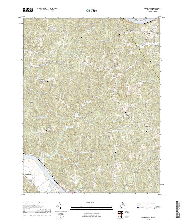
2023 Map of Mount Alto
USGS Topo · Published 2023About this map
Mount Alto and the surrounding borderland of Jackson and Mason counties are defined by a complex network of ridges and springs in this recent survey. To the south, the Kanawha River marks the landscape near the settlement of Leon, while the interior is a high-relief terrain characterized by Thomas Ridge, Plants Ridge, and Yauger Ridge. Small communities like Rollins and Baden are situated along winding valley roads, often identified by their proximity to generational landmarks such as the Everett Keefer Spring or the Cleon Cadle Spring.
Find a feature on this map
115 named features on this map. Tap any name to fly to it.
Don’t see what you’re looking for? This feature index may not catch every label — zoom into the map to look around manually.
Map Details
Editions of this 2023 Mount Alto Map
This is the sole edition of this map. No revisions or reprints were ever made.
Other maps of this area

1906 · Glenwood
USGS Topo · 1:62,500

1906 · Winfield
USGS Topo · 1:62,500

1908 · Glenwood
USGS Topo · 1:62,500

1908 · Winfield
USGS Topo · 1:62,500

1908 · Ravenswood
USGS Topo · 1:62,500

1908 · Point Pleasant
USGS Topo · 1:62,500

1926 · Ravenswood
USGS Topo · 1:62,500

1926 · Point Pleasant
USGS Topo · 1:62,500

1928 · Ravenswood
USGS Topo · 1:62,500

1929 · Point Pleasant
USGS Topo · 1:62,500