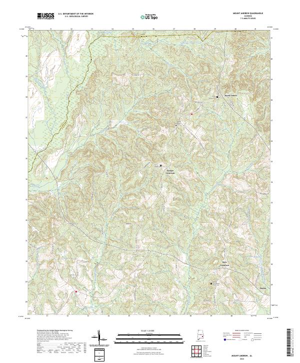
2024 Map of Mount Andrew
USGS Topo · Published 2024About this map
Mount Andrew serves as a central point in this rural Barbour County landscape, situated near the headwaters of several drainages that define the local topography. The area is characterized by a series of prominent crossroads, including Garmon Crossroads and Bells Crossroads, which traditionally functioned as focal points for the surrounding agricultural community. The map reveals a dense network of local routes such as Evergreen Rd and Dry Creek Rd, connecting scattered farmsteads and religious centers like Pleasant Grove Baptist Church.
Find a feature on this map
58 named features on this map. Tap any name to fly to it.
Don’t see what you’re looking for? This feature index may not catch every label — zoom into the map to look around manually.
Map Details
Editions of this 2024 Mount Andrew Map
This is the sole edition of this map. No revisions or reprints were ever made.
Other maps of this area

1953 · Dothan
USGS Topo · 1:250,000

1954 · Dothan
USGS Topo · 1:250,000

1955 · Dothan
USGS Topo · 1:250,000

1955 · Phenix City
USGS Topo · 1:250,000

1957 · Phenix City
USGS Topo · 1:250,000

1958 · Phenix City
USGS Topo · 1:250,000

1967 · Clayton South
USGS Topo · 1:24,000

1968 · Clayton North
USGS Topo · 1:24,000

1968 · Perote
USGS Topo · 1:24,000

1968 · Louisville
USGS Topo · 1:24,000