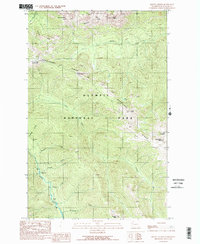
1990 Map of Mount Angeles
USGS Topo · Published 1990About this map
Hurricane Ridge dominates this 1990 survey of the Olympic Peninsula high country, where alpine peaks and deep river valleys define the interior of Olympic National Park. The Hurricane Ridge Visitors Center serves as a primary access point to this elevation-rich landscape, which includes prominent summits such as Mount Angeles and Eagle Point. The map provides detailed tracking of the drainage systems shaping the terrain, specifically the Elwha River on the western edge and the Lillian River bisecting the central slopes. For those tracing the human footprint in these protected lands, the map identifies specific backcountry locations like Marys Falls Camp and Canyon Camp, alongside notable geological features such as Steeple Rock and Klahhane Ridge. The network of creeks, including Windfall Creek and Wildrose Creek, illustrates the complex hydrology that feeds the peninsula's major river systems.
Find a feature on this map
24 named features on this map. Tap any name to fly to it.
Don’t see what you’re looking for? This feature index may not catch every label — zoom into the map to look around manually.
Map Details
Editions of this 1990 Mount Angeles Map
2 editions found
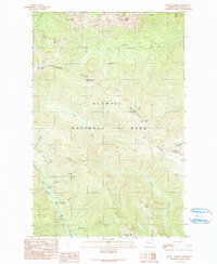
Other maps of this area

1918 · Port Angeles
USGS Topo · 1:62,500

1919 · Port Crescent
USGS Topo · 1:62,500

1935 · Mount Olympus
USGS Topo · 1:62,500

1938 · Mt Constance
USGS Topo · 1:125,000

1941 · Port Angeles
USGS Topo · 1:62,500

1942 · Mount Olympus
USGS Topo · 1:62,500

1944 · Mt. Angeles
USGS Topo · 1:62,500

1946 · Mt. Angeles
USGS Topo · 1:62,500

1950 · Elwha
USGS Topo · 1:24,000

1950 · Hurricane Hill
USGS Topo · 1:24,000