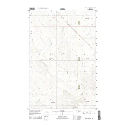
2014 Map of Mount Antelope
USGS Topo · Published 2014About this map
Mt Antelope and the Big Sheep Mountains define this high-plains landscape along the border of McCone and Dawson counties. The terrain is deeply incised by a series of drainages, including Hell Cr, McCone Cr, and the W Fork Buffalo Springs Cr, which flow through the dissected plateaus typical of this region. Human presence in this area is primarily marked by water management and transit routes through the open country. The Quick Reservoir provides a crucial water source in the northern sections, while Deep Bottom and Upper Sevenmile Cr trace the natural lowlands. Transportation is facilitated by a network of rural routes such as MT-200s and Circle Tower Hl, connecting the isolated ridges and creek beds that characterize the Big Sheep Mountains area.
Find a feature on this map
22 named features on this map. Tap any name to fly to it.
Don’t see what you’re looking for? This feature index may not catch every label — zoom into the map to look around manually.
Map Details
Editions of this 2014 Mount Antelope Map
This is the sole edition of this map. No revisions or reprints were ever made.
Other maps of this area

1954 · Glendive
USGS Topo · 1:250,000

1957 · Glendive
USGS Topo · 1:250,000

1958 · Glendive
USGS Topo · 1:250,000

1982 · Circle
USGS Topo · 1:100,000
1983 · Union School
USGS Topo · 1:24,000

1983 · Woodworth Hill
USGS Topo · 1:24,000

1983 · Olson Coulee South
USGS Topo · 1:24,000

1983 · Mount Antelope
USGS Topo · 1:24,000

1983 · Quick Reservoir
USGS Topo · 1:24,000

1983 · Circle
USGS Topo · 1:24,000