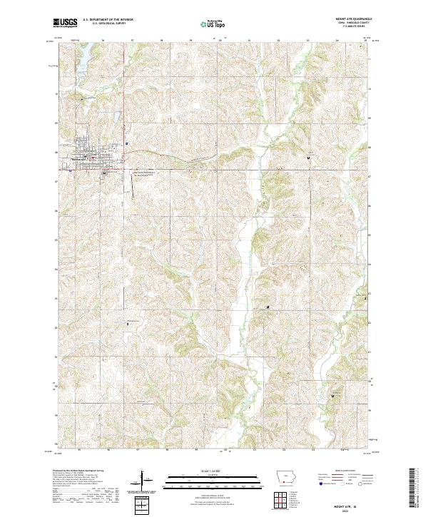
2022 Map of Mount Ayr
USGS Topo · Published 2022About this map
The Ringgold County Courthouse serves as the focal point for Mount Ayr, the county seat of Ringgold County. This township structure is characterized by a grid of agricultural sections divided by the E Fork Grand River and its various tributaries like Gooseberry Cr and Bealls Cr. The landscape is a mix of traditional prairie farmland and essential community infrastructure, including the Judge Lewis Field/Mount Ayr Municipal Airport located just east of the primary settlement.
Find a feature on this map
56 named features on this map. Tap any name to fly to it.
Don’t see what you’re looking for? This feature index may not catch every label — zoom into the map to look around manually.
Map Details
Editions of this 2022 Mount Ayr Map
This is the sole edition of this map. No revisions or reprints were ever made.
Other maps of this area

1940 · Blockton
USGS Topo · 1:62,500

1943 · Blockton
USGS Topo · 1:62,500

1945 · Mount Ayr
USGS Topo · 1:62,500

1947 · Mount Ayr
USGS Topo · 1:62,500

1955 · Nebraska City
USGS Topo · 1:250,000

1957 · Nebraska City
USGS Topo · 1:250,000

1958 · Nebraska City
USGS Topo · 1:250,000
1981 · Blockton SE
USGS Topo · 1:24,000
1981 · Diagonal
USGS Topo · 1:24,000
1981 · Pawnee
USGS Topo · 1:24,000