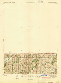
1947 Map of Mount Ayr
USGS Topo · Published 1947About this map
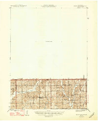
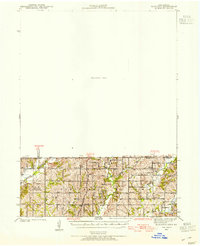
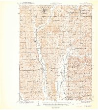
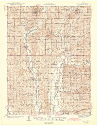
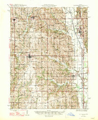
Hatfield and Pawnee anchor this rural landscape along the Iowa-Missouri border shortly after the war. The map reveals a densely organized network of rural education and worship, with local landmarks like Turkey Grove Sch, Friendship Ch, and Lotts Grove Ch serving as community hubs for Lincoln and Hamilton townships. The drainage patterns of Lotts Creek and Muddy Creek define the agricultural layout, while primary transit is facilitated by U. S. Route 15 and State Route 25.
Find a feature on this map
24 named features on this map. Tap any name to fly to it.
Don’t see what you’re looking for? This feature index may not catch every label — zoom into the map to look around manually.
Map Details
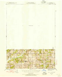
Editions of this 1947 Mount Ayr Map
2 editions found
Other maps of this area
1940 · Blockton
USGS Topo · 1:62,500
1942 · Grant City
USGS Topo · 1:62,500
1943 · Grant City
USGS Topo · 1:62,500
1943 · Blockton
USGS Topo · 1:62,500
1945 · Mount Ayr
USGS Topo · 1:62,500
1945 · Lamoni
USGS Topo · 1:62,500
1947 · Lamoni
USGS Topo · 1:62,500
1947 · Blythedale
USGS Topo · 1:62,500
1947 · Mount Ayr
USGS Topo · 1:62,500
1948 · Bethany
USGS Topo · 1:62,500