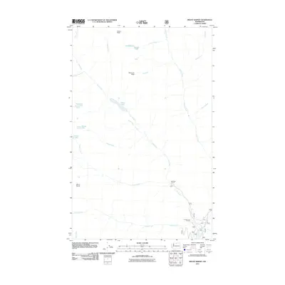
2011 Map of Mount Barney
USGS Topo · Published 2011About this map
Mount Barney rises as a prominent landmark in this high-elevation landscape of Okanogan County, characterized by a complex network of glacial lakes and steep drainage basins. The area's hydrology is defined by the Chewuch River in the southeast corner, which collects waters from a vast system of tributaries including Lake Creek, Farewell Creek, and Disaster Creek. Historical access points for packers and backcountry travelers are anchored by the Lake Creek Trailhead and Farewell Creek Trailhead, providing entry into a terrain marked by distinctive features like Black Lake Ridge and Preston Ridge.
Find a feature on this map
25 named features on this map. Tap any name to fly to it.
Don’t see what you’re looking for? This feature index may not catch every label — zoom into the map to look around manually.
Map Details
Editions of this 2011 Mount Barney Map
This is the sole edition of this map. No revisions or reprints were ever made.
Other maps of this area

1955 · Concrete
USGS Topo · 1:250,000

1958 · Concrete
USGS Topo · 1:250,000

1962 · Concrete
USGS Topo · 1:250,000

1962 · Mazama
USGS Topo · 1:62,500

1963 · Doe Mountain
USGS Topo · 1:62,500

1969 · Mt. Barney
USGS Topo · 1:24,000

1969 · Remmel Mtn.
USGS Topo · 1:24,000

1969 · Billy Goat Mtn
USGS Topo · 1:24,000

1969 · Ashnola Pass
USGS Topo · 1:24,000
1969 · Coleman Peak
USGS Topo · 1:24,000