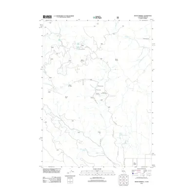
2012 Map of Mount Bidwell
USGS Topo · Published 2012About this map
Yellow Mountain and the high elevations of the Warner Mountains dominate this high-desert landscape near the Oregon-California border. In the early 2010s, this area remained largely defined by seasonal recreational use and aviation access via the Fort Bidwell Airport. The map highlights a network of forest roads like Highgrade Rd and Bidwell Creek Rd that provide access to remote water sources such as Mineral Spring and Highgrade Spring. Public land use is evident through the presence of the Lilly Lake Picnic Area and the Larry Flat Campground, while the Mount Vida Vista Scene Viewpoint indicates the significance of the terrain's visual command over the region. Water remains a focal point in this arid environment, represented by small alpine features like Cave Lake and the Burger Reservoir.
Find a feature on this map
52 named features on this map. Tap any name to fly to it.
Don’t see what you’re looking for? This feature index may not catch every label — zoom into the map to look around manually.
Map Details
Editions of this 2012 Mount Bidwell Map
This is the sole edition of this map. No revisions or reprints were ever made.
Other maps of this area

1886 · Alturas
USGS Topo · 1:250,000

1892 · Alturas
USGS Topo · 1:250,000

1954 · Alturas
USGS Topo · 1:250,000

1955 · Klamath Falls
USGS Topo · 1:250,000

1958 · Alturas
USGS Topo · 1:250,000

1958 · Klamath Falls
USGS Topo · 1:250,000

1962 · Alturas
USGS Topo · 1:250,000

1962 · Willow Ranch
USGS Topo · 1:62,500

1962 · Fort Bidwell
USGS Topo · 1:62,500
1964 · Crane Creek
USGS Topo · 1:24,000