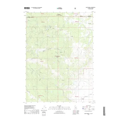
2018 Map of Mount Bidwell
USGS Topo · Published 2018About this map
Fremont National Forest and Modoc National Forest meet at the intersection of the Oregon and California state line, framing a high-elevation landscape defined by significant water resources and early industrial activity. The presence of Old Mines and the Morrell Mine near Yellow Mtn points to a history of resource extraction, while the numerous named springs and water bodies such as Mineral Spring, Highgrade Spring, and Lily Lake suggest the importance of water management in this arid mountain region. Further south, the Fort Bidwell Airport provides a modern navigational landmark at the edge of the valley, while the rugged interior is traversed by the Highgrade National Rec Trail. This terrain transitions from the marshy Dismal Swamp in the north to high meadows like Indian Meadow, illustrating the diverse montane environments concentrated around Mt Bidwell.
Find a feature on this map
43 named features on this map. Tap any name to fly to it.
Don’t see what you’re looking for? This feature index may not catch every label — zoom into the map to look around manually.
Map Details
Editions of this 2018 Mount Bidwell Map
This is the sole edition of this map. No revisions or reprints were ever made.
Other maps of this area

1886 · Alturas
USGS Topo · 1:250,000

1892 · Alturas
USGS Topo · 1:250,000

1954 · Alturas
USGS Topo · 1:250,000

1955 · Klamath Falls
USGS Topo · 1:250,000

1958 · Alturas
USGS Topo · 1:250,000

1958 · Klamath Falls
USGS Topo · 1:250,000

1962 · Alturas
USGS Topo · 1:250,000

1962 · Willow Ranch
USGS Topo · 1:62,500

1962 · Fort Bidwell
USGS Topo · 1:62,500
1964 · Crane Creek
USGS Topo · 1:24,000