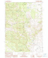
1990 Map of Mount Bidwell
USGS Topo · Published 1990About this map
The Fort Bidwell Indian Reservation and the town of Fort Bidwell anchor the southern reaches of this map, where the high desert meets the base of the Warner Mountains. This late-twentieth-century study of the corner where California and Oregon meet reveals a landscape defined by historical extraction and alpine water management. A high concentration of mining sites, including the Moonlight Mines, Sunshine Mine, and Klondyke Mines, are scattered across the northern slopes, signaling the region’s enduring mineral interest.
Find a feature on this map
44 named features on this map. Tap any name to fly to it.
Don’t see what you’re looking for? This feature index may not catch every label — zoom into the map to look around manually.
Map Details
Editions of this 1990 Mount Bidwell Map
This is the sole edition of this map. No revisions or reprints were ever made.
Other maps of this area

1886 · Alturas
USGS Topo · 1:250,000

1892 · Alturas
USGS Topo · 1:250,000

1954 · Alturas
USGS Topo · 1:250,000

1955 · Klamath Falls
USGS Topo · 1:250,000

1958 · Alturas
USGS Topo · 1:250,000

1958 · Klamath Falls
USGS Topo · 1:250,000

1962 · Alturas
USGS Topo · 1:250,000

1962 · Willow Ranch
USGS Topo · 1:62,500

1962 · Fort Bidwell
USGS Topo · 1:62,500
1964 · Crane Creek
USGS Topo · 1:24,000