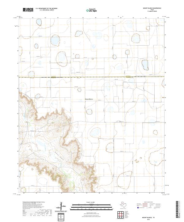
2022 Map of Mount Blanco
USGS Topo · Published 2022About this map
Blanco Canyon dominates the southwestern quadrant of this landscape, where the White River and Crawfish Cr have carved deep relief into the High Plains. This topographic study shows the rural character of the region along the boundary of Floyd Co and Crosby Co. The settlement of Mount Blanco sits at a crossroads on the plateau above the canyon, serving as a focal point for the surrounding network of section-line roads like Co RD 116 and Co RD 215. The contrast between the flat, gridded agricultural land and the irregular erosion of the canyon system reflects the geological transition at the edge of the Caprock. Transportation through the area is facilitated by Fm 1958 and Ranch Rd 193, which bridge the gap between isolated ranchsteads and the larger drainage basins.
Find a feature on this map
35 named features on this map. Tap any name to fly to it.
Don’t see what you’re looking for? This feature index may not catch every label — zoom into the map to look around manually.
Map Details
Editions of this 2022 Mount Blanco Map
This is the sole edition of this map. No revisions or reprints were ever made.
Other maps of this area

1954 · Lubbock
USGS Topo · 1:250,000

1965 · Floydada
USGS Topo · 1:24,000

1965 · Floydada SE
USGS Topo · 1:24,000

1965 · Wake
USGS Topo · 1:24,000

1965 · Boothe
USGS Topo · 1:24,000

1966 · Crosbyton
USGS Topo · 1:24,000

1966 · Mount Blanco
USGS Topo · 1:24,000

1966 · McAdoo
USGS Topo · 1:24,000

1967 · Ralls NE
USGS Topo · 1:24,000
1968 · Dougherty
USGS Topo · 1:24,000