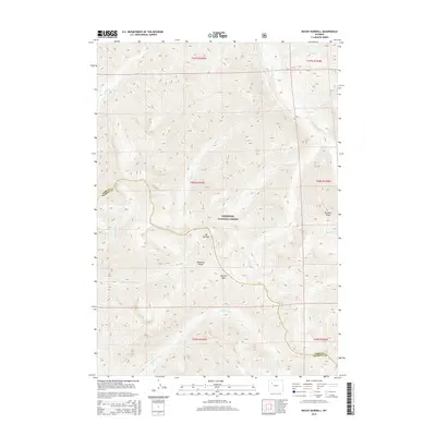
2015 Map of Mount Burwell
USGS Topo · Published 2015About this map
Mt Burwell and the high summits of the Absaroka Range dominate this portion of the Shoshone National Forest, where the landscape is defined by its dramatic drainage systems. The northern sections are carved by the Greybull River and its tributaries, including Mabel Cr and Venus Cr, while the southern reaches fall toward the Wiggins Fork. These watercourses create a natural divide between the rugged peaks like Pyramid Peak and the high-elevation crossing at Burwell Pass. The map traces the boundary between Park and Fremont counties as it traverses this high-country wilderness. Historically, this terrain served as a critical headwaters region, with numerous named streams such as Bonne Cr, Caldwell Cr, and Steer Cr illustrating the complex hydrologic network of the forest long before modern development reached these elevations.
Find a feature on this map
26 named features on this map. Tap any name to fly to it.
Don’t see what you’re looking for? This feature index may not catch every label — zoom into the map to look around manually.
Map Details
Editions of this 2015 Mount Burwell Map
This is the sole edition of this map. No revisions or reprints were ever made.
Other maps of this area

1893 · Ishawooa
USGS Topo · 1:125,000

1895 · Ishawooa
USGS Topo · 1:125,000

1899 · Ishawooa
USGS Topo · 1:125,000

1904 · Kirwin
USGS Topo · 1:125,000

1905 · Younts Peak
USGS Topo · 1:125,000

1906 · Kirwin
USGS Topo · 1:125,000

1907 · Younts Peak
USGS Topo · 1:125,000

1955 · Cody
USGS Topo · 1:250,000

1955 · Thermopolis
USGS Topo · 1:250,000

1956 · Snow Lake
USGS Topo · 1:24,000