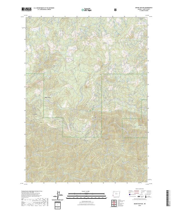
2024 Map of Mount Butler
USGS Topo · Published 2024About this map
The Siskiyou National Forest dominates this coastal mountain landscape, where the Sixes River and its numerous tributaries like Edson Creek and Elephant Rock Creek carve through the steep terrain. This 2024 topographic survey reveals a rugged wilderness character, defined by the protected expanse of the Grassy Knob Wilderness and the Elk Wild and Scenic River corridor in the south. Unlike many coastal regions, this area shows minimal modern development, with landmarks such as Plum Trees and the Calf Ranch Prairie hinting at historical land use patterns. Notable elevations like Edson Butte, China Peak, and Mount Butler provide a clear view of the complex drainage network that feeds the regional river systems. The inclusion of the Nat For Dev Rd 5105 and Co Hwy 184 provides the primary access points into this dense forest environment.
Find a feature on this map
35 named features on this map. Tap any name to fly to it.
Don’t see what you’re looking for? This feature index may not catch every label — zoom into the map to look around manually.
Map Details
Editions of this 2024 Mount Butler Map
This is the sole edition of this map. No revisions or reprints were ever made.
Other maps of this area

1899 · Port Orford
USGS Topo · 1:125,000

1903 · Port Orford
USGS Topo · 1:125,000

1954 · Coos Bay
USGS Topo · 1:250,000

1954 · Port Orford
USGS Topo · 1:62,500

1954 · Agness
USGS Topo · 1:62,500

1954 · Powers
USGS Topo · 1:62,500

1954 · Langlois
USGS Topo · 1:62,500

1958 · Coos Bay
USGS Topo · 1:250,000

1962 · Coos Bay
USGS Topo · 1:250,000
1985 · Calf Ranch Mtn
USGS Topo · 1:24,000