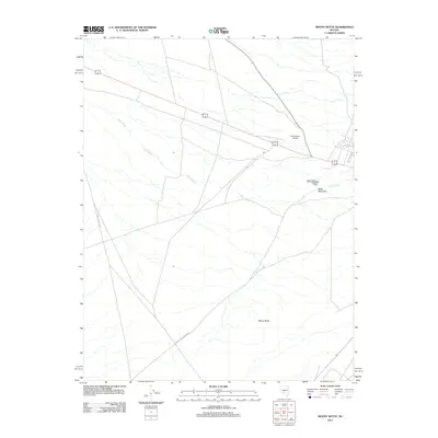
2012 Map of Mount Butte
USGS Topo · Published 2012About this map
Slime Wash defines the drainage patterns of this high-desert landscape near Tonopah, cutting through the arid terrain between prominent elevations. The area is anchored by Mount Butte in the south and the distinct plateau of Table Mountain to the east. Transportation and aviation infrastructure highlight the human footprint in this corner of Nye County, centered around the Lambertucci Airstrip. This regional hub for small craft is connected by a network of rural routes and thoroughfares including Miller's Cutoff and Paymaster Canyon Rd. The map illustrates a modern era of desert transit, where local access roads like Sage Dr meet larger logistical arteries, reflecting the continued utility of these remote basins for aviation and transit in the early twenty-first century.
Find a feature on this map
7 named features on this map. Tap any name to fly to it.
Don’t see what you’re looking for? This feature index may not catch every label — zoom into the map to look around manually.
Map Details
Editions of this 2012 Mount Butte Map
This is the sole edition of this map. No revisions or reprints were ever made.
Other maps of this area

1907 · Tonopah
USGS Topo · 1:250,000

1908 · Lida
USGS Topo · 1:250,000

1908 · Tonopah
USGS Topo · 1:250,000

1913 · Lida
USGS Topo · 1:250,000

1945 · Goldfield
USGS Topo · 1:125,000

1952 · Mud Lake
USGS Topo · 1:62,500

1954 · Goldfield
USGS Topo · 1:250,000

1955 · Goldfield
USGS Topo · 1:250,000

1956 · Tonopah
USGS Topo · 1:250,000

1958 · Goldfield
USGS Topo · 1:250,000