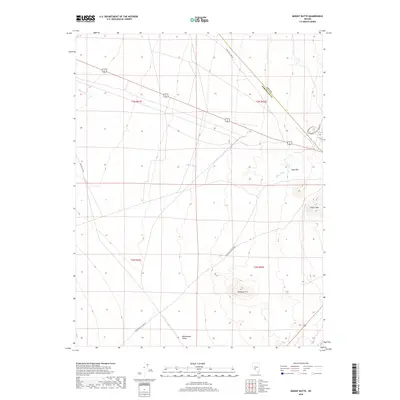
2018 Map of Mount Butte
USGS Topo · Published 2018About this map
The Montezuma Valley provides the setting for this high-desert region, where the prominent landmark of Mt Butte rises above the basin floor. Located along the border of Nye and Esmeralda counties, the landscape is defined by its distinct volcanic peaks and broad desert washes. To the north and east, the terrain elevates toward Table Mtn and Siebert Mtn, while the drainage of Slime Wash cuts through the flats. This 2018 survey captures a remote portion of the Nevada desert characterized by utility and transport corridors, including Gabbs Pole Line Rd and Miller's Cutoff. While few settlements appear on this specific sheet, the presence of named access roads like Paymaster Canyon Rd and Radar Rd indicates the area's continued use for ranching, mining access, or communications infrastructure.
Find a feature on this map
16 named features on this map. Tap any name to fly to it.
Don’t see what you’re looking for? This feature index may not catch every label — zoom into the map to look around manually.
Map Details
Editions of this 2018 Mount Butte Map
This is the sole edition of this map. No revisions or reprints were ever made.
Other maps of this area

1907 · Tonopah
USGS Topo · 1:250,000

1908 · Lida
USGS Topo · 1:250,000

1908 · Tonopah
USGS Topo · 1:250,000

1913 · Lida
USGS Topo · 1:250,000

1945 · Goldfield
USGS Topo · 1:125,000

1952 · Mud Lake
USGS Topo · 1:62,500

1954 · Goldfield
USGS Topo · 1:250,000

1955 · Goldfield
USGS Topo · 1:250,000

1956 · Tonopah
USGS Topo · 1:250,000

1958 · Goldfield
USGS Topo · 1:250,000