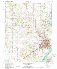
1959 Map of Mount Carmel
USGS Topo · Published 1989About this map
Mount Carmel serves as the focal point of this late 1950s survey, situated where the Wabash River meets the White River along the Illinois-Indiana border. The landscape is a complex mix of river bottomlands, such as Patoka Island, and upland settlements marked by an extensive network of rural churches and family burial grounds. Researchers can trace the path of the Old Indian Treaty Boundary as it cuts across the terrain northwest of the city, passing near Asbury Chapel. The region's mid-century infrastructure is well-documented, featuring the Oil Pumping Sta near Odgen, several dedicated school sites like North Sch and South Sch, and local rail-linked locations including Schrodts Station. Numerous cemeteries, including Nye Chapel Cem, Hallock Cem, and Harper Cem, provide significant genealogical touchstones throughout the quadrangle.
Find a feature on this map
44 named features on this map. Tap any name to fly to it.
Don’t see what you’re looking for? This feature index may not catch every label — zoom into the map to look around manually.
Map Details
Editions of this 1959 Mount Carmel Map
4 editions found
Other maps of this area

1901 · Princeton
USGS Topo · 1:62,500

1903 · Princeton
USGS Topo · 1:62,500

1903 · Patoka
USGS Topo · 1:125,000

1904 · Mount Carmel
USGS Topo · 1:62,500

1911 · Sumner
USGS Topo · 1:62,500

1913 · Sumner
USGS Topo · 1:62,500

1915 · Vincennes
USGS Topo · 1:62,500

1944 · Vincennes
USGS Topo · 1:62,500

1956 · Vincennes
USGS Topo · 1:250,000

1957 · Vincennes
USGS Topo · 1:250,000