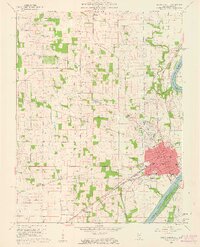
1959 Map of Mount Carmel
USGS Topo · Published 1961About this map
The Wabash River serves as a natural boundary between Illinois and Indiana, framing the riverfront city of Mount Carmel in the late 1950s. This survey records a landscape shaped by both early history and modern infrastructure, where the Old Indian Treaty Boundary still cuts across the township lines north of the city. Transportation networks define the region's economy, with the Southern and New York Central railroads converging near the river, while smaller settlements like Friendsville and Patton dot the rural interior.
Find a feature on this map
47 named features on this map. Tap any name to fly to it.
Don’t see what you’re looking for? This feature index may not catch every label — zoom into the map to look around manually.
Map Details
Editions of this 1959 Mount Carmel Map
4 editions found
Other maps of this area

1901 · Princeton
USGS Topo · 1:62,500

1903 · Princeton
USGS Topo · 1:62,500

1903 · Patoka
USGS Topo · 1:125,000

1904 · Mount Carmel
USGS Topo · 1:62,500

1911 · Sumner
USGS Topo · 1:62,500

1913 · Sumner
USGS Topo · 1:62,500

1915 · Vincennes
USGS Topo · 1:62,500

1944 · Vincennes
USGS Topo · 1:62,500

1956 · Vincennes
USGS Topo · 1:250,000

1957 · Vincennes
USGS Topo · 1:250,000