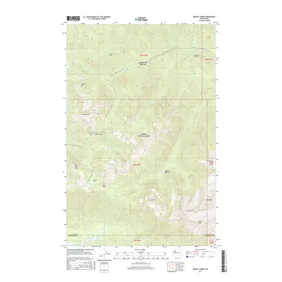
2017 Map of Mount Carrie
USGS Topo · Published 2017About this map
Olympic Hot Springs serves as a prominent landmark in the northern reaches of Olympic National Park, situated at the terminus of the Olympic Hot Springs Rd. This high-elevation survey illustrates the dramatic alpine hydrology of the Olympic Mountains, where the Sol Duc River and the Hoh River find their headwaters among towering peaks and remnant ice. The High Divide separates these major drainage systems, creating a notable geographic spine through the center of the sheet.
Find a feature on this map
45 named features on this map. Tap any name to fly to it.
Don’t see what you’re looking for? This feature index may not catch every label — zoom into the map to look around manually.
Map Details
Editions of this 2017 Mount Carrie Map
This is the sole edition of this map. No revisions or reprints were ever made.
Other maps of this area

1918 · Lake Crescent
USGS Topo · 1:62,500

1919 · Port Crescent
USGS Topo · 1:62,500

1922 · Lake Crescent
USGS Topo · 1:62,500

1935 · Mount Olympus
USGS Topo · 1:62,500

1939 · Mount Tom
USGS Topo · 1:62,500

1942 · Mount Olympus
USGS Topo · 1:62,500

1950 · Elwha
USGS Topo · 1:24,000

1950 · Hurricane Hill
USGS Topo · 1:24,000

1950 · Lake Sutherland
USGS Topo · 1:24,000

1950 · Lake Crescent
USGS Topo · 1:24,000