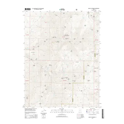
2014 Map of Mount Catherine
USGS Topo · Published 2014About this map
Mt Catherine stands as a prominent high point in this high-altitude landscape within the Fishlake National Forest, where the border of Millard and Sevier Counties meets. The terrain is defined by a dense network of drainages and ridges, including Teeples Ridge and Blue Ridge, which feed into complex canyon systems like Pharo Canyon and Teeples Canyon. Numerous vital water sources are scattered throughout these elevations, such as Teeples Spring, Shingle Mill Spring, and Number Three Spring, highlighting the critical role of these mountain seeps for local livestock or wildlife. Human passage through this steep country is primarily marked by Chalk Creek Canyon Rd, which follows the natural corridor of the N Fork Chalk Cr. This map provides a clear view of the complex topography and the network of namesake peaks like Pioneer Peak and Willow Creek Peak that dominate this portion of the Utah range.
Find a feature on this map
88 named features on this map. Tap any name to fly to it.
Don’t see what you’re looking for? This feature index may not catch every label — zoom into the map to look around manually.
Map Details
Editions of this 2014 Mount Catherine Map
This is the sole edition of this map. No revisions or reprints were ever made.
Other maps of this area

1885 · Beaver
USGS Topo · 1:250,000

1885 · Sevier Desert
USGS Topo · 1:250,000

1953 · Richfield
USGS Topo · 1:250,000

1953 · Delta
USGS Topo · 1:250,000

1958 · Richfield
USGS Topo · 1:250,000

1958 · Delta
USGS Topo · 1:250,000

1961 · Fillmore
USGS Topo · 1:24,000

1961 · Mt. Catherine
USGS Topo · 1:24,000

1961 · Richfield
USGS Topo · 1:62,500

1962 · Delta
USGS Topo · 1:250,000