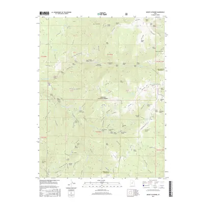
2017 Map of Mount Catherine
USGS Topo · Published 2017About this map
Mount Catherine and the high summits of the Pahvant Range dominate this portion of the Fishlake National Forest, where the border of Millard and Sevier counties meets. The landscape is defined by a dense network of high-altitude drainage systems and ridges, including Teeples Ridge and Blue Ridge. Human passage through this high country is marked by numerous designated paths such as Trail 1428 and the Paradise Cyn ATV route, reflecting the area's modern use for recreation and forest management.
Find a feature on this map
91 named features on this map. Tap any name to fly to it.
Don’t see what you’re looking for? This feature index may not catch every label — zoom into the map to look around manually.
Map Details
Editions of this 2017 Mount Catherine Map
This is the sole edition of this map. No revisions or reprints were ever made.
Other maps of this area

1885 · Beaver
USGS Topo · 1:250,000

1885 · Sevier Desert
USGS Topo · 1:250,000

1953 · Richfield
USGS Topo · 1:250,000

1953 · Delta
USGS Topo · 1:250,000

1958 · Richfield
USGS Topo · 1:250,000

1958 · Delta
USGS Topo · 1:250,000

1961 · Fillmore
USGS Topo · 1:24,000

1961 · Mt. Catherine
USGS Topo · 1:24,000

1961 · Richfield
USGS Topo · 1:62,500

1962 · Delta
USGS Topo · 1:250,000