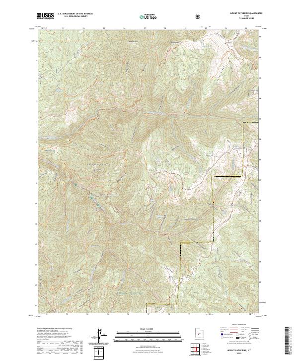
2023 Map of Mount Catherine
USGS Topo · Published 2023About this map
Mt Catherine and Pioneer Peak anchor the northern reaches of this high-elevation landscape within the Fishlake National Forest. The map documents a complex drainage system where the Pahvant Range is dissected by numerous steep corridors like Hardscrabble Canyon, Snow Canyon, and Magpie Canyon. Human passage through this terrain is defined by a dense network of historic and modern trails, including the Richfield-Pioneer route and the Paiute (D-1) Trail.
Find a feature on this map
85 named features on this map. Tap any name to fly to it.
Don’t see what you’re looking for? This feature index may not catch every label — zoom into the map to look around manually.
Map Details
Editions of this 2023 Mount Catherine Map
This is the sole edition of this map. No revisions or reprints were ever made.
Other maps of this area

1885 · Beaver
USGS Topo · 1:250,000

1885 · Sevier Desert
USGS Topo · 1:250,000

1953 · Richfield
USGS Topo · 1:250,000

1953 · Delta
USGS Topo · 1:250,000

1958 · Richfield
USGS Topo · 1:250,000

1958 · Delta
USGS Topo · 1:250,000

1961 · Fillmore
USGS Topo · 1:24,000

1961 · Mt. Catherine
USGS Topo · 1:24,000

1961 · Richfield
USGS Topo · 1:62,500

1962 · Delta
USGS Topo · 1:250,000