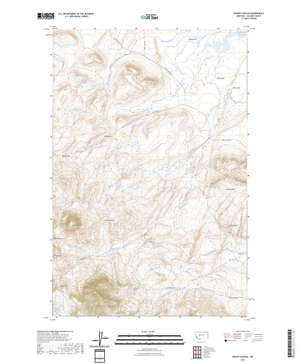
2024 Map of Mount Cecelia
USGS Topo · Published 2024About this map
Mt Cecelia and the surrounding high country of Cascade County dominate this landscape, defined by a series of prominent buttes and hills. The terrain is marked by distinct landmarks such as Black Butte, Skull Butte, and Johnson Butte, which rise above the surrounding flats and drainage basins. Water sources in this arid stretch of Montana include Hunters Creek in the north and the Rocky Reef Reservoir tucked near Rocky Reef.
Find a feature on this map
32 named features on this map. Tap any name to fly to it.
Don’t see what you’re looking for? This feature index may not catch every label — zoom into the map to look around manually.
Map Details
Editions of this 2024 Mount Cecelia Map
This is the sole edition of this map. No revisions or reprints were ever made.
Other maps of this area

1886 · Great Falls
USGS Topo · 1:250,000

1949 · Cascade
USGS Topo · 1:62,500

1951 · Cascade
USGS Topo · 1:62,500

1954 · Great Falls
USGS Topo · 1:250,000

1957 · Great Falls
USGS Topo · 1:250,000

1960 · Simms
USGS Topo · 1:62,500

1961 · Hardy
USGS Topo · 1:24,000

1961 · Rocky Reef
USGS Topo · 1:24,000
1961 · Mid Canon
USGS Topo · 1:24,000
1976 · Great Falls South
USGS Topo · 1:100,000