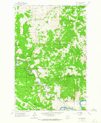
1961 Map of Mid Canon
USGS Topo · Published 1964About this map
The confluence of the Dearborn River and the Missouri River defines this 1961 field-checked landscape along the boundary of Cascade and Lewis and Clark Counties. The map reveals a post-homesteading era where the remains of early ranching and settlement are clearly noted, including the Levofski Homestead (Aband), McKinster Homestead (Aband), and several others. This documentation of abandoned sites offers significant value for genealogists and researchers tracing the movement of families through the canyon country during the mid-20th century.
Find a feature on this map
24 named features on this map. Tap any name to fly to it.
Don’t see what you’re looking for? This feature index may not catch every label — zoom into the map to look around manually.
Map Details
Editions of this 1961 Mid Canon Map
2 editions found
Other maps of this area

1886 · Great Falls
USGS Topo · 1:250,000

1943 · Hogan
USGS Topo · 1:125,000

1954 · Great Falls
USGS Topo · 1:250,000

1955 · Choteau
USGS Topo · 1:250,000

1957 · Choteau
USGS Topo · 1:250,000

1957 · Great Falls
USGS Topo · 1:250,000

1958 · Choteau
USGS Topo · 1:250,000

1960 · Simms
USGS Topo · 1:62,500

1961 · Craig
USGS Topo · 1:24,000

1961 · Hardy
USGS Topo · 1:24,000