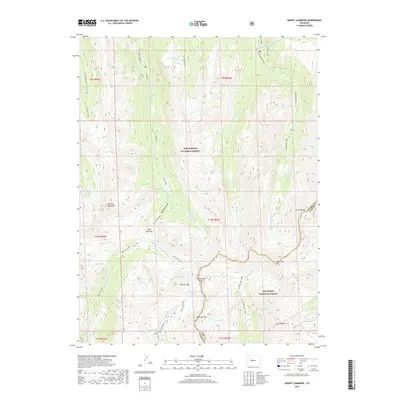
2019 Map of Mount Champion
USGS Topo · Published 2019About this map
The Continental Divide bisects this high-elevation landscape where the Pitkin Co Lake Co boundary line follows the crest of the Sawatch Range. This 2019 survey documents a complex hydrological environment defined by trans-mountain water projects, including the Charles H Boustead Tunnel and the Chapman Tunnel, which redirect water beneath the divide. The peaks of Mt Champion and Mt Oklahoma dominate the eastern reaches, while the White River National Forest and San Isabel National Forest converge at the ridge. Recreation and transit are visible through the winding Lost Man Loop and the presence of the Midway area. Glacial remnants and alpine basins are evident in the numerous water bodies such as Fryingpan Lakes, Lost Man Lake, and Independence Lake, which feed the headwaters of the Roaring Fork River and the Fryingpan River.
Find a feature on this map
52 named features on this map. Tap any name to fly to it.
Don’t see what you’re looking for? This feature index may not catch every label — zoom into the map to look around manually.
Map Details
Editions of this 2019 Mount Champion Map
This is the sole edition of this map. No revisions or reprints were ever made.
Other maps of this area

1889 · Leadville
USGS Topo · 1:125,000

1891 · Leadville
USGS Topo · 1:125,000

1909 · Mount Jackson
USGS Topo · 1:125,000

1911 · Mount Jackson
USGS Topo · 1:125,000

1935 · Mount Elbert
USGS Topo · 1:62,500

1938 · Mount Elbert
USGS Topo · 1:62,500

1939 · Mount Elbert
USGS Topo · 1:62,500

1942 · Leadville
USGS Topo · 1:125,000

1949 · Holy Cross
USGS Topo · 1:62,500

1951 · Holy Cross
USGS Topo · 1:62,500