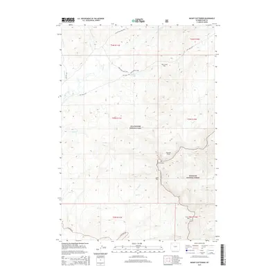
2015 Map of Mount Chittenden
USGS Topo · Published 2015About this map
Mt Chittenden and the high peaks of the Absaroka Range dominate this 2015 survey of the Wyoming backcountry. The map documents a critical transition point between Yellowstone National Park and the Shoshone National Forest, illustrating the high-altitude hydrology of the region. A network of primitive paths, including the Pelican Cone Cabin Trail, Mist Creek Trail, and the Raven Creek Cutoff Trail, provides the only access through this roadless terrain, connecting isolated landmarks like the Pelican Springs Cabin. Notable drainage systems such as Pelican Creek and Bear Cr carve through the landscape, defined by steep contour intervals and significant alpine passes like Mist Creek Pass and Jones Pass. The presence of Stonecup Lake high in the Absarokas provides a rare still-water feature among the numerous mountain streams.
Find a feature on this map
32 named features on this map. Tap any name to fly to it.
Don’t see what you’re looking for? This feature index may not catch every label — zoom into the map to look around manually.
Map Details
Editions of this 2015 Mount Chittenden Map
This is the sole edition of this map. No revisions or reprints were ever made.
Other maps of this area

1885 · Lake
USGS Topo · 1:125,000

1886 · Canyon
USGS Topo · 1:125,000

1895 · Canyon
USGS Topo · 1:125,000

1895 · Lake
USGS Topo · 1:125,000

1896 · Lake
USGS Topo · 1:125,000

1896 · Canyon
USGS Topo · 1:125,000

1901 · Canyon
USGS Topo · 1:125,000

1901 · Lake
USGS Topo · 1:125,000

1906 · Lake
USGS Topo · 1:125,000

1907 · Canyon
USGS Topo · 1:125,000