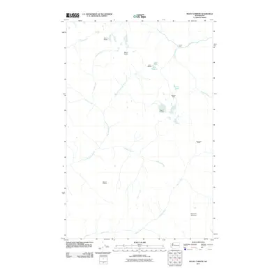
2011 Map of Mount Christie
USGS Topo · Published 2011About this map
Low Divide serves as a critical geographic saddle in this high-elevation landscape, separating the headwaters of the North Fork Quinault River from the north-flowing Elwha River. This 2011 survey reveals the isolated backcountry character of the Olympic interior, where transit is defined by primitive trails and remote waypoints. Notable stopping points for travelers include Chicago Camp near the northern boundary and Twelve Mile Shelter in the southeast. The terrain is dominated by prominent summits such as Mount Christie and Mount Seattle, while smaller features like Lake Mary and Lake Margaret occupy the high basins. The drainage network is dense, featuring curiously named tributaries like Geoduck Creek and Promise Creek, illustrating the complex water systems that feed the region's major river valleys.
Find a feature on this map
20 named features on this map. Tap any name to fly to it.
Don’t see what you’re looking for? This feature index may not catch every label — zoom into the map to look around manually.
Map Details
Editions of this 2011 Mount Christie Map
This is the sole edition of this map. No revisions or reprints were ever made.
Other maps of this area

1935 · Mount Olympus
USGS Topo · 1:62,500

1938 · Mt Constance
USGS Topo · 1:125,000

1942 · Mount Olympus
USGS Topo · 1:62,500

1944 · Mt. Angeles
USGS Topo · 1:62,500

1946 · Mt. Angeles
USGS Topo · 1:62,500

1947 · Mt. Steel
USGS Topo · 1:62,500

1947 · Mt Christie
USGS Topo · 1:62,500

1950 · Mt Christie
USGS Topo · 1:62,500

1950 · Mt. Steel
USGS Topo · 1:62,500

1956 · Mount Olympus
USGS Topo · 1:62,500