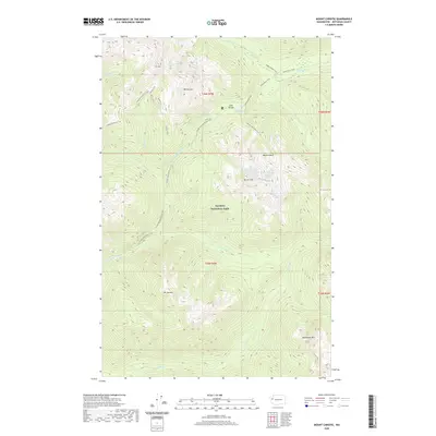
2020 Map of Mount Christie
USGS Topo · Published 2020About this map
Low Divide serves as the central hydrologic and geographic pivot of this high-elevation wilderness within Olympic National Park. This pass separates the headwaters of the northward-flowing Elwha River from the southward-flowing N Fork Quinault River, a natural corridor that has historically facilitated travel across the Olympic interior. High alpine peaks dominate the landscape, including Mt Christie, Mt Seattle, and Mt Noyes. The map reveals a network of high-country routes including the Skyline Trail and Skyline Primitive Trail, alongside remote water bodies like Lake Mary and Lake Margaret. The concentration of trails at Low Divide underscores its significance as a critical junction for backcountry travel between the Quinault and Elwha watersheds.
Find a feature on this map
29 named features on this map. Tap any name to fly to it.
Don’t see what you’re looking for? This feature index may not catch every label — zoom into the map to look around manually.
Map Details
Editions of this 2020 Mount Christie Map
This is the sole edition of this map. No revisions or reprints were ever made.
Other maps of this area

1935 · Mount Olympus
USGS Topo · 1:62,500

1938 · Mt Constance
USGS Topo · 1:125,000

1942 · Mount Olympus
USGS Topo · 1:62,500

1944 · Mt. Angeles
USGS Topo · 1:62,500

1946 · Mt. Angeles
USGS Topo · 1:62,500

1947 · Mt. Steel
USGS Topo · 1:62,500

1947 · Mt Christie
USGS Topo · 1:62,500

1950 · Mt Christie
USGS Topo · 1:62,500

1950 · Mt. Steel
USGS Topo · 1:62,500

1956 · Mount Olympus
USGS Topo · 1:62,500