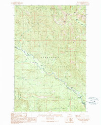
1989 Map of Mount Christie
USGS Topo · Published 1989About this map
Mount Clifty stands at the intersection of high ridges and deep river drainages within the Wenatchee National Forest and Snoqualmie National Forest. This 1989 provisional map documents a wilderness landscape defined by the upper reaches of the Little Naches River, where seasonal meadows like Mathew Meadow and Longmire Meadow break up the timbered terrain. The presence of the Taneum Shelter, Naches Pass Campsite, and Crow Creek Campground indicates the area's established role for backcountry travel and recreation, supported by a network of 4wd tracks and foot trails. In the southwest, the Norse Peak Wilderness boundary marks a transition into more protected territory. The map also records localized industrial activity along the river corridors, including a Borrow Pit and several Gravel Pits, likely used for the maintenance of forest access roads.
Find a feature on this map
48 named features on this map. Tap any name to fly to it.
Don’t see what you’re looking for? This feature index may not catch every label — zoom into the map to look around manually.
Map Details
Editions of this 1989 Mount Christie Map
This is the sole edition of this map. No revisions or reprints were ever made.
Other maps of this area

1935 · Mount Olympus
USGS Topo · 1:62,500

1938 · Mt Constance
USGS Topo · 1:125,000

1942 · Mount Olympus
USGS Topo · 1:62,500

1944 · Mt. Angeles
USGS Topo · 1:62,500

1946 · Mt. Angeles
USGS Topo · 1:62,500

1947 · Mt. Steel
USGS Topo · 1:62,500

1947 · Mt Christie
USGS Topo · 1:62,500

1950 · Mt Christie
USGS Topo · 1:62,500

1950 · Mt. Steel
USGS Topo · 1:62,500

1956 · Mount Olympus
USGS Topo · 1:62,500