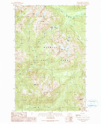
1990 Map of Mount Christie
USGS Topo · Published 1990About this map
Olympic National Park defines this landscape of high peaks and river headwaters in the late twentieth century. Centered on the Low Divide, the map illustrates a remote wilderness where the North Fork Quinault River and the Elwha River nearly meet. Notable human markers in this roadless backcountry include the Low Divide Ranger Station and several trail-side camps such as Chicago Camp and Twelvemile Shelter.
Find a feature on this map
22 named features on this map. Tap any name to fly to it.
Don’t see what you’re looking for? This feature index may not catch every label — zoom into the map to look around manually.
Map Details
Editions of this 1990 Mount Christie Map
This is the sole edition of this map. No revisions or reprints were ever made.
Other maps of this area

1935 · Mount Olympus
USGS Topo · 1:62,500

1938 · Mt Constance
USGS Topo · 1:125,000

1942 · Mount Olympus
USGS Topo · 1:62,500

1944 · Mt. Angeles
USGS Topo · 1:62,500

1946 · Mt. Angeles
USGS Topo · 1:62,500

1947 · Mt. Steel
USGS Topo · 1:62,500

1947 · Mt Christie
USGS Topo · 1:62,500

1950 · Mt Christie
USGS Topo · 1:62,500

1950 · Mt. Steel
USGS Topo · 1:62,500

1956 · Mount Olympus
USGS Topo · 1:62,500