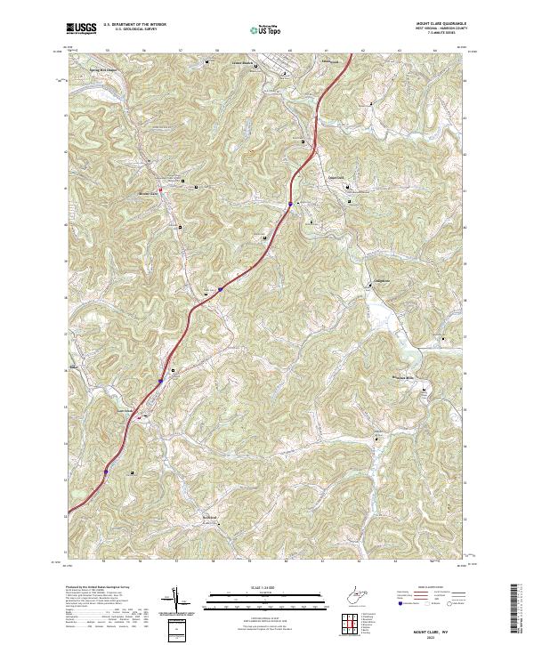
2023 Map of Mount Clare
USGS Topo · Published 2023About this map
Mount Clare and Lost Creek anchor this survey of the Harrison County landscape, where the winding waters of the West Fork River and Elk Creek dictate the local geography. The area's history is deeply etched in its numerous small burial grounds and family landmarks, such as the Independent Order of Odd Fellows Cem and the William Cunningham Spring. The conversion of former industrial corridors is evident in the Harrison South Rail-Trl, which now follows the path of the old railroad through the valley. Smaller communities like Quiet Dell, Romines Mills, and Rockford are connected by a network of rural routes and hollows, including Stark Hollow and Pheasant Ridge. This map captures a modern view of a region where tradition persists through sites like the Spring Hill Chapel and the Brick Church, even as newer landmarks like Floral Hills Memorial Gardens take their place.
Find a feature on this map
88 named features on this map. Tap any name to fly to it.
Don’t see what you’re looking for? This feature index may not catch every label — zoom into the map to look around manually.
Map Details
Editions of this 2023 Mount Clare Map
This is the sole edition of this map. No revisions or reprints were ever made.
Historical Maps of Spring Hill Chapel Through Time
4 maps found