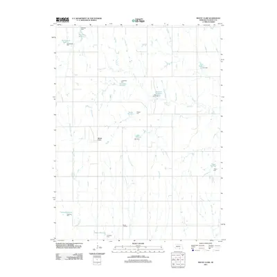
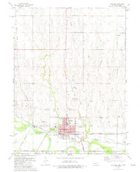
2011 Map of Mount Clare
USGS Topo · Published 2011About this map
Mount Clare serves as the central focal point of this agricultural landscape in Nuckolls County, characterized by a sophisticated network of private and municipal water management. The terrain is defined by the winding paths of Cottonwood Creek, Elk Creek, and Middle Creek, which support a high concentration of named reservoirs and dams. These features, often bearing local family names like Hoelting, Buschkoetter, Thayer, and Childress, illustrate the intensive land use and the critical importance of water storage for the surrounding rural homesteads. In the southern portion of the quadrangle, Beulah Cemetery remains a significant marker for those tracing local family lineages. The mapping by the U.S. Geological Survey provides a detailed view of the section lines and rural road grids that have structured this portion of Nebraska since its settlement.
Find a feature on this map
24 named features on this map. Tap any name to fly to it.
Don’t see what you’re looking for? This feature index may not catch every label — zoom into the map to look around manually.
Map Details
Editions of this 2011 Mount Clare Map
This is the sole edition of this map. No revisions or reprints were ever made.
Other maps of this area

1898 · Superior
USGS Topo · 1:125,000

1955 · Grand Island
USGS Topo · 1:250,000

1957 · Grand Island
USGS Topo · 1:250,000

1958 · Grand Island
USGS Topo · 1:250,000
1960 · Fairfield SE
USGS Topo · 1:24,000

1960 · Deweese
USGS Topo · 1:24,000

1969 · Lawrence
USGS Topo · 1:24,000
1974 · Guide Rock
USGS Topo · 1:24,000
1974 · Mount Clare
USGS Topo · 1:24,000
1974 · Superior
USGS Topo · 1:24,000