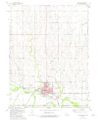
1974 Map of Superior
USGS Topo · Published 1977About this map
Superior dominates this mid-1970s landscape, positioned just north of the Republican River at the Nebraska Kansas border. The town is a concentrated hub of local civic life, featuring North Ward School, South Ward School, and Lincoln Park, while the Ladies Evergreen Cemetery lies just to the north. The area's infrastructure is defined by a dense network of transit and utility, including the Burlington Northern and Atchison Topeka and Santa Fe lines, alongside an Industrial Railroad serving the gravel pits to the west.
Find a feature on this map
29 named features on this map. Tap any name to fly to it.
Don’t see what you’re looking for? This feature index may not catch every label — zoom into the map to look around manually.
Map Details
Editions of this 1974 Superior Map
2 editions found
Other maps of this area

1892 · Concordia
USGS Topo · 1:125,000

1894 · Mankato
USGS Topo · 1:125,000

1898 · Superior
USGS Topo · 1:125,000

1898 · Hebron
USGS Topo · 1:125,000

1955 · Manhattan
USGS Topo · 1:250,000

1955 · Lincoln
USGS Topo · 1:250,000

1955 · Grand Island
USGS Topo · 1:250,000

1955 · Beloit
USGS Topo · 1:250,000

1956 · Manhattan
USGS Topo · 1:250,000

1957 · Manhattan
USGS Topo · 1:250,000