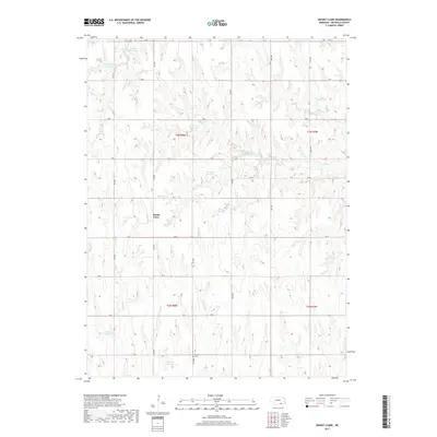
2017 Map of Mount Clare
USGS Topo · Published 2017About this map
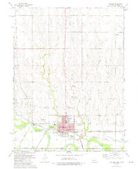
Mount Clare sits at the heart of this rural Nuckolls County landscape, where the agricultural grid is defined by a dense network of sectional roads such as RD N and RD 2800. The terrain is deeply incised by the drainage systems of Middle Cr, Cottonwood Cr, and Sand Cr, which flow through the southern reaches of the quadrangle. This 2017 survey reveals an extensive water management system across the plains, marked by numerous small private impoundments including Buschkoetter Reservoir, Tumbelson Reservoir, and the NBC Reservoir. These features reflect the localized nature of water storage in this part of Nebraska. For those researching family history in the area, Beulah Cem is a prominent landmark located near the southern boundary, situated between the upper reaches of Sand Cr and the Childress Reservoir.
Find a feature on this map
37 named features on this map. Tap any name to fly to it.
Don’t see what you’re looking for? This feature index may not catch every label — zoom into the map to look around manually.
Map Details
Editions of this 2017 Mount Clare Map
This is the sole edition of this map. No revisions or reprints were ever made.
Other maps of this area

1898 · Superior
USGS Topo · 1:125,000

1955 · Grand Island
USGS Topo · 1:250,000

1957 · Grand Island
USGS Topo · 1:250,000

1958 · Grand Island
USGS Topo · 1:250,000
1960 · Fairfield SE
USGS Topo · 1:24,000

1960 · Deweese
USGS Topo · 1:24,000

1969 · Lawrence
USGS Topo · 1:24,000
1974 · Guide Rock
USGS Topo · 1:24,000
1974 · Mount Clare
USGS Topo · 1:24,000
1974 · Superior
USGS Topo · 1:24,000