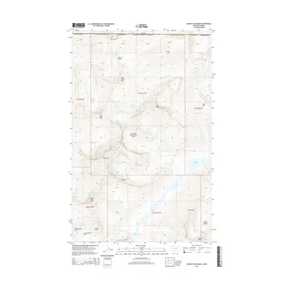
2014 Map of Mount Cleveland
USGS Topo · Published 2014About this map
Mt Cleveland and the high peaks of the Lewis Range dominate this 2014 survey along the international boundary between Montana and Canada. This high-altitude landscape is defined by its extreme hydrography, where the N Fork Belly River and Mokowanis River drain a series of alpine basins. The map captures several active ice features, including the Miche Wabun Glacier, Whitecrow Glacier, and Old Sun Glacier, which feed into deep glacial lakes like Glenns Lake and Cosley Lake. Notable for local-history and geographic study is the remote Stoney Indian Pass, a high-elevation crossing located between Wahcheechee Mtn and the Stoney Indian Peaks. The presence of numerous named falls, such as Miche Wabun Falls and White Quiver Falls, underscores the steep vertical relief of the Wilson Range and the Glacier National Park interior.
Find a feature on this map
47 named features on this map. Tap any name to fly to it.
Don’t see what you’re looking for? This feature index may not catch every label — zoom into the map to look around manually.
Map Details
Editions of this 2014 Mount Cleveland Map
This is the sole edition of this map. No revisions or reprints were ever made.
Other maps of this area

1904 · Chief Mountain
USGS Topo · 1:125,000

1938 · Chief Mountain
USGS Topo · 1:125,000

1960 · Cut Bank
USGS Topo · 1:250,000

1963 · Cut Bank
USGS Topo · 1:250,000

1964 · Cut Bank
USGS Topo · 1:250,000

1968 · Ahern Pass
USGS Topo · 1:24,000

1968 · Gable Mountain
USGS Topo · 1:24,000
1968 · Porcupine Ridge
USGS Topo · 1:24,000
1968 · Mount Cleveland
USGS Topo · 1:24,000
1968 · Mount Geduhn
USGS Topo · 1:24,000