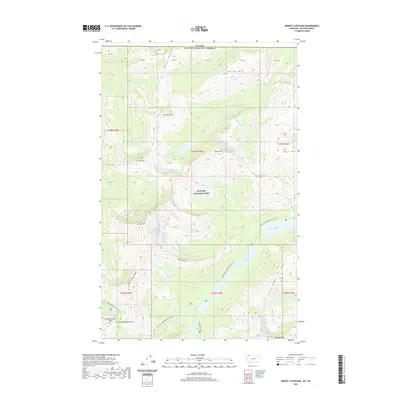
2020 Map of Mount Cleveland
USGS Topo · Published 2020About this map
Glacier National Park defines this section of the northern border, where the high peaks of the Witson Range and Mt Cleveland dominate the landscape. This 2020 survey documents the complex hydrology of the Continental Divide, featuring the headwaters of the Mokowanis River and the N Fork Belly River. The international boundary between the Canada and the United States of America runs along the northern edge of the map, cutting across high summits like Sarcee Mtn and Miche Wabun Peak.
Find a feature on this map
47 named features on this map. Tap any name to fly to it.
Don’t see what you’re looking for? This feature index may not catch every label — zoom into the map to look around manually.
Map Details
Editions of this 2020 Mount Cleveland Map
This is the sole edition of this map. No revisions or reprints were ever made.
Other maps of this area

1904 · Chief Mountain
USGS Topo · 1:125,000

1938 · Chief Mountain
USGS Topo · 1:125,000

1960 · Cut Bank
USGS Topo · 1:250,000

1963 · Cut Bank
USGS Topo · 1:250,000

1964 · Cut Bank
USGS Topo · 1:250,000

1968 · Ahern Pass
USGS Topo · 1:24,000

1968 · Gable Mountain
USGS Topo · 1:24,000
1968 · Porcupine Ridge
USGS Topo · 1:24,000
1968 · Mount Cleveland
USGS Topo · 1:24,000
1968 · Mount Geduhn
USGS Topo · 1:24,000