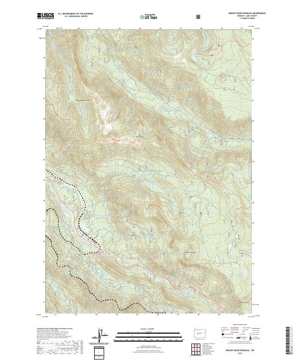
2023 Map of Mount David Douglas
USGS Topo · Published 2023About this map
Mt David Douglas dominates this high-elevation landscape within the Willamette National Forest, where steep ridgelines and deep drainage basins define the drainage patterns of the Salt Creek watershed. The area is characterized by a dense network of mountain trails, including the Eugene To Pacific Crest Trl and the Bunchgrass Trl, which navigate the complex topography of Bunchgrass Ridge and Big Bunchgrass. To the northeast, the Waldo Lake Wilderness protects a high-country environment featuring Spirit Lake and Koch Mtn. The hydrology of the region is intricate, with numerous named streams such as Black Creek and South Fork Salt Creek carving through the terrain. Notable local landmarks like Rhododendron Island and the isolated Lucas Lake provide specific points of interest for those studying the natural geography and recreational history of Lane County.
Find a feature on this map
46 named features on this map. Tap any name to fly to it.
Don’t see what you’re looking for? This feature index may not catch every label — zoom into the map to look around manually.
Map Details
Editions of this 2023 Mount David Douglas Map
This is the sole edition of this map. No revisions or reprints were ever made.
Other maps of this area

1925 · Waldo Lake
USGS Topo · 1:125,000

1955 · Chucksney Mtn
USGS Topo · 1:62,500

1956 · Waldo Lake
USGS Topo · 1:62,500

1956 · Oakridge
USGS Topo · 1:62,500

1956 · Sardine Butte
USGS Topo · 1:62,500

1958 · Roseburg
USGS Topo · 1:250,000

1959 · Roseburg
USGS Topo · 1:250,000

1983 · Oakridge
USGS Topo · 1:100,000
1986 · Willamette Pass
USGS Topo · 1:24,000
1986 · Groundhog Mountain
USGS Topo · 1:24,000