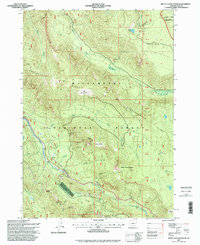
1997 Map of Mount David Douglas
USGS Topo · Published 1998About this map
Salt Creek carves a deep corridor through this high-elevation terrain in the late 1990s, serving as the primary transportation artery through the Willamette National Forest. The map documents the intricate relationship between the mountain landscape and the infrastructure built to navigate it, most notably the presence of multiple snowsheds and a Runaway Truck Ramp along the steep grades near Cruzatte. These features, combined with several quarries and the proximity of Mount David Douglas, indicate a landscape shaped by both rigorous forest management and the demands of heavy mountain transit.
Find a feature on this map
36 named features on this map. Tap any name to fly to it.
Don’t see what you’re looking for? This feature index may not catch every label — zoom into the map to look around manually.
Map Details
Editions of this 1997 Mount David Douglas Map
This is the sole edition of this map. No revisions or reprints were ever made.
Other maps of this area

1925 · Waldo Lake
USGS Topo · 1:125,000

1955 · Chucksney Mtn
USGS Topo · 1:62,500

1956 · Waldo Lake
USGS Topo · 1:62,500

1956 · Oakridge
USGS Topo · 1:62,500

1956 · Sardine Butte
USGS Topo · 1:62,500

1958 · Roseburg
USGS Topo · 1:250,000

1959 · Roseburg
USGS Topo · 1:250,000

1983 · Oakridge
USGS Topo · 1:100,000
1986 · Willamette Pass
USGS Topo · 1:24,000
1986 · Groundhog Mountain
USGS Topo · 1:24,000