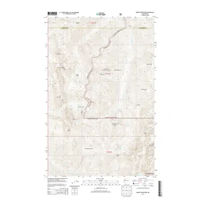
2014 Map of Mount Deception
USGS Topo · Published 2014About this map
Mt Deception and the surrounding high peaks of the Olympic Mountains dominate this 2014 survey, which tracks the high-altitude terrain along the boundary of Clallam and Jefferson counties. The landscape is defined by its verticality, from the sharp ridges of The Needles and Gray Wolf Ridge to deep glacial basins like Royal Basin and Deception Basin. Water sources are numerous but concentrated in alpine lakes and headwater creeks, including Royal Lake, Home Lake, and the tucked-away Lake Constance.
Find a feature on this map
48 named features on this map. Tap any name to fly to it.
Don’t see what you’re looking for? This feature index may not catch every label — zoom into the map to look around manually.
Map Details
Editions of this 2014 Mount Deception Map
This is the sole edition of this map. No revisions or reprints were ever made.
Other maps of this area

1938 · Mt Constance
USGS Topo · 1:125,000

1944 · Mt. Angeles
USGS Topo · 1:62,500

1946 · Mt. Angeles
USGS Topo · 1:62,500

1946 · Tyler Peak
USGS Topo · 1:62,500

1947 · The Brothers
USGS Topo · 1:62,500

1947 · Mt. Steel
USGS Topo · 1:62,500

1948 · Tyler Peak
USGS Topo · 1:62,500

1950 · The Brothers
USGS Topo · 1:62,500

1950 · Mt. Steel
USGS Topo · 1:62,500

1958 · Seattle
USGS Topo · 1:250,000