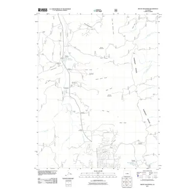
2011 Map of Mount Deception
USGS Topo · Published 2011About this map
Trout Creek carves a central valley through this section of the Rocky Mountains, creating a corridor of recreation and historical landmarks north of Woodland Park. The landscape is defined by the Rampart Range to the east and prominent peaks like Mount Deception and Soldier Mountain rising above numerous gulches. Water management and community gathering points are central to the area's layout, evidenced by the Manitou Park Dam forming Manitou Park Lake and the presence of the Manitou Park Grange. While much of the terrain is dedicated to public land and timber, sites like the Sky High Girl Scout Camp and the Worden Ranch show the mix of youth education and private ranching interests. The southern portion of the map transitions into the residential outskirts of the community, where the Woodland Park Reservoir and Woodland Park Dam serve the local population near the headwaters of South Beaver Creek.
Find a feature on this map
59 named features on this map. Tap any name to fly to it.
Don’t see what you’re looking for? This feature index may not catch every label — zoom into the map to look around manually.
Map Details
Editions of this 2011 Mount Deception Map
This is the sole edition of this map. No revisions or reprints were ever made.
Other maps of this area

1893 · Platte Canyon
USGS Topo · 1:125,000

1893 · Colorado Springs
USGS Topo · 1:125,000

1894 · Pikes Peak
USGS Topo · 1:125,000

1894 · Castle Rock
USGS Topo · 1:125,000

1901 · Pikes Peak
USGS Topo · 1:125,000

1901 · Pikes Peak
USGS Topo · 1:62,500

1909 · Colorado Springs
USGS Topo · 1:125,000

1913 · Castle Rock
USGS Topo · 1:125,000

1942 · Colorado Springs
USGS Topo · 1:125,000

1948 · Colorado Springs
USGS Topo · 1:62,500