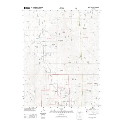
2013 Map of Mount Deception
USGS Topo · Published 2013About this map
The City of Woodland Park serves as the primary hub in this corner of the Pike National Forest, where the high-altitude landscape is defined by deep gulches and significant mountain peaks. The map reveals a transition from the urban grid of Woodland Park, with streets like Sunnywood Ave and Pembrook Dr, into the preserved wilderness of the Rampart Range. Landmarks such as Mount Deception and Soldier Mountain overlook a complex network of canyons and gulches, including Limbaugh Canyon and Lovell Gulch. Water management and recreation are central to the area's layout, evidenced by the Woodland Park Reservoir and the Manitou Park Lake near the Manitou Park Grange. Numerous seasonal camps and recreational sites, such as the Sky High Girl Scout Camp and Farish Memorial Recreation Area, emphasize the region's long-standing role as a mountain retreat and resource area.
Find a feature on this map
79 named features on this map. Tap any name to fly to it.
Don’t see what you’re looking for? This feature index may not catch every label — zoom into the map to look around manually.
Map Details
Editions of this 2013 Mount Deception Map
This is the sole edition of this map. No revisions or reprints were ever made.
Other maps of this area

1893 · Platte Canyon
USGS Topo · 1:125,000

1893 · Colorado Springs
USGS Topo · 1:125,000

1894 · Pikes Peak
USGS Topo · 1:125,000

1894 · Castle Rock
USGS Topo · 1:125,000

1901 · Pikes Peak
USGS Topo · 1:125,000

1901 · Pikes Peak
USGS Topo · 1:62,500

1909 · Colorado Springs
USGS Topo · 1:125,000

1913 · Castle Rock
USGS Topo · 1:125,000

1942 · Colorado Springs
USGS Topo · 1:125,000

1948 · Colorado Springs
USGS Topo · 1:62,500