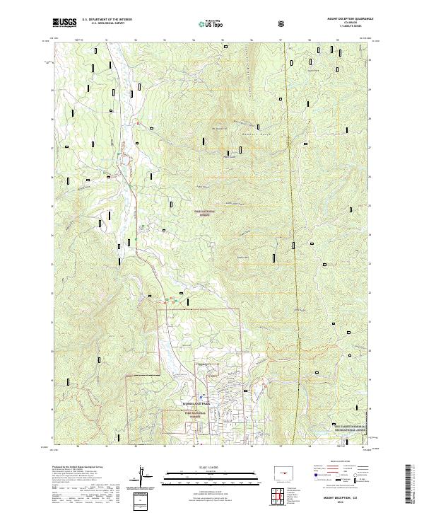
2022 Map of Mount Deception
USGS Topo · Published 2022About this map
Woodland Park serves as the primary hub for this portion of the Pike National Forest, where the residential street grid gives way to the high-elevation terrain of the Rampart Range. The landscape is defined by deep drainages like Lovell Gulch and South Fork Missouri Gulch, with prominent summits including Mt Deception and Soldier Mtn rising above the valleys. Water management and recreation are central to the area's layout, evidenced by Manitou Lake and the Woodland Park Reservoir.
Find a feature on this map
85 named features on this map. Tap any name to fly to it.
Don’t see what you’re looking for? This feature index may not catch every label — zoom into the map to look around manually.
Map Details
Editions of this 2022 Mount Deception Map
This is the sole edition of this map. No revisions or reprints were ever made.
Other maps of this area

1893 · Platte Canyon
USGS Topo · 1:125,000

1893 · Colorado Springs
USGS Topo · 1:125,000

1894 · Pikes Peak
USGS Topo · 1:125,000

1894 · Castle Rock
USGS Topo · 1:125,000

1901 · Pikes Peak
USGS Topo · 1:125,000

1901 · Pikes Peak
USGS Topo · 1:62,500

1909 · Colorado Springs
USGS Topo · 1:125,000

1913 · Castle Rock
USGS Topo · 1:125,000

1942 · Colorado Springs
USGS Topo · 1:125,000

1948 · Colorado Springs
USGS Topo · 1:62,500