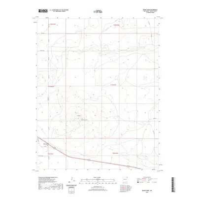
2020 Map of Mount Dora
USGS Topo · Published 2020About this map
Mount Dora and its surrounding plateau terrain define this corner of Union County, characterized by a complex network of intermittent drainages and prominent mesas. The settlement itself sits near the intersection of Loop Rd and local county routes, while the broader landscape is marked by the volcanic profile of Mt Dora and the deep incisions of Apache Canyon. These geographic features dictate the local road network, where routes like Sand Mesa Rd and Kimble Rd navigate the high plains.
Find a feature on this map
24 named features on this map. Tap any name to fly to it.
Don’t see what you’re looking for? This feature index may not catch every label — zoom into the map to look around manually.
Map Details
Editions of this 2020 Mount Dora Map
This is the sole edition of this map. No revisions or reprints were ever made.
Other maps of this area

1954 · Dalhart
USGS Topo · 1:250,000

1958 · Dalhart
USGS Topo · 1:250,000

1962 · Dalhart
USGS Topo · 1:250,000

1966 · Royce
USGS Topo · 1:24,000

1966 · Black Canyon
USGS Topo · 1:24,000

1972 · Mc Laughlin Bridge
USGS Topo · 1:24,000

1972 · Mount Dora
USGS Topo · 1:24,000

1972 · Bible Top Butte
USGS Topo · 1:24,000
1972 · Boiler Gap
USGS Topo · 1:24,000

1973 · Snyder Lake
USGS Topo · 1:24,000