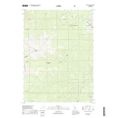
2018 Map of Mount Eddy
USGS Topo · Published 2018About this map
Mt Eddy dominates this high-altitude landscape where the headwaters of several major systems originate. The terrain is a complex hydrologic divide within the Shasta National Forest, feeding the N Fork Sacramento River, the Middle Fork Sacramento River, and the Shasta River. High-elevation alpine basins contain numerous water bodies like Toad Lake, Little Crater Lake, and Durney Lake, while the eastern portion of the map transitions into more accessible valleys near the settlement of Deetz.
Find a feature on this map
52 named features on this map. Tap any name to fly to it.
Don’t see what you’re looking for? This feature index may not catch every label — zoom into the map to look around manually.
Map Details
Editions of this 2018 Mount Eddy Map
This is the sole edition of this map. No revisions or reprints were ever made.
Other maps of this area

1886 · Shasta
USGS Topo · 1:250,000

1894 · Shasta
USGS Topo · 1:250,000

1923 · Sawyers Bar
USGS Topo · 1:125,000

1931 · Etna
USGS Topo · 1:96,000

1934 · Etna
USGS Topo · 1:125,000

1935 · Dunsmuir
USGS Topo · 1:125,000

1948 · Weed
USGS Topo · 1:250,000

1950 · Weed
USGS Topo · 1:250,000

1954 · Weed
USGS Topo · 1:62,500

1954 · Dunsmuir
USGS Topo · 1:62,500