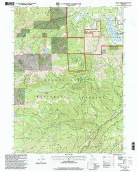
1998 Map of Mount Eddy
USGS Topo · Published 2003About this map
Mount Eddy dominates this high-elevation landscape within the Shasta-Trinity National Forests, marking the boundary between Siskiyou and Trinity counties. The hydrology of the region is well-defined by the headwaters of the Shasta River and several branches of the Sacramento River, including the Middle Fork and South Fork. Human interaction with the landscape is evident through water management and recreation infrastructure, notably the Concrete Diversion Dam and Wood Diversion Dam, and the Luginbuhl Lodge to the northeast. Historical transit and modern recreation paths such as the Sisson Calahan Trail and North Fork Trail traverse the steep terrain of Rainbow Ridge and Scott Camp Ridge, providing access to alpine waters like Little Crater Lake, Dobbins Lake, and Toad Lake. Small-scale resource extraction is also noted by a Mine and Prospect located near the upper reaches of Dale Creek.
Find a feature on this map
38 named features on this map. Tap any name to fly to it.
Don’t see what you’re looking for? This feature index may not catch every label — zoom into the map to look around manually.
Map Details
Editions of this 1998 Mount Eddy Map
This is the sole edition of this map. No revisions or reprints were ever made.
Other maps of this area

1886 · Shasta
USGS Topo · 1:250,000

1894 · Shasta
USGS Topo · 1:250,000

1923 · Sawyers Bar
USGS Topo · 1:125,000

1931 · Etna
USGS Topo · 1:96,000

1934 · Etna
USGS Topo · 1:125,000

1935 · Dunsmuir
USGS Topo · 1:125,000

1948 · Weed
USGS Topo · 1:250,000

1950 · Weed
USGS Topo · 1:250,000

1954 · Weed
USGS Topo · 1:62,500

1954 · Dunsmuir
USGS Topo · 1:62,500