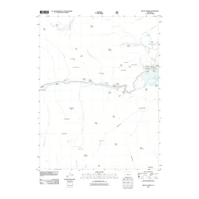
2011 Map of Mount Elbert
USGS Topo · Published 2011About this map
Mount Elbert anchors the Sawatch Range on this survey, presiding over a landscape defined by high-altitude mining legacies and alpine water systems. The map traces the corridor of Lake Creek as it flows toward the expansive Twin Lakes, a primary geographical feature that has shaped local settlement from the mining era through the development of outdoor recreation. The concentration of claims in the northeastern quadrant, such as the Golden Fleece Mine and Bengal Tiger Mine, illustrates the intensity of mineral exploration across the peaks and gulches. Further south, the settlement of Vicksburg sits along the drainage of Sheep Gulch, while the western edge is dominated by massive peaks like La Plata Peak and Casco Peak. Engineering works like the Arlington Ditch and the Cozart Dam at Cozart Reservoir highlight the sophisticated water management required in this high-mountain environment.
Find a feature on this map
70 named features on this map. Tap any name to fly to it.
Don’t see what you’re looking for? This feature index may not catch every label — zoom into the map to look around manually.
Map Details
Editions of this 2011 Mount Elbert Map
This is the sole edition of this map. No revisions or reprints were ever made.
Other maps of this area

1889 · Leadville
USGS Topo · 1:125,000

1891 · Leadville
USGS Topo · 1:125,000

1909 · Mount Jackson
USGS Topo · 1:125,000

1911 · Mount Jackson
USGS Topo · 1:125,000

1934 · Taylor Park
USGS Topo · 1:62,500

1935 · Mount Elbert
USGS Topo · 1:62,500

1937 · Taylor Park
USGS Topo · 1:62,500

1938 · Mount Elbert
USGS Topo · 1:62,500

1939 · Mount Elbert
USGS Topo · 1:62,500

1942 · Leadville
USGS Topo · 1:125,000