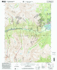
1994 Map of Mount Elbert
USGS Topo · Published 2001About this map
Mount Elbert and surrounding high peaks dominate this landscape in the mid-1990s, revealing a region defined by alpine summits and a legacy of hard-rock mining. The topography is marked by numerous historic operations such as the Iron Mike Mine, Golden Fleece Mine, and the Vesuvius Mine, scattered across gulches and ridges within the San Isabel National Forest. This era shows the developed recreation and preservation of the area, including the Twin Lakes Historic District and the Colorado Trail winding through the high country.
Find a feature on this map
58 named features on this map. Tap any name to fly to it.
Don’t see what you’re looking for? This feature index may not catch every label — zoom into the map to look around manually.
Map Details
Editions of this 1994 Mount Elbert Map
This is the sole edition of this map. No revisions or reprints were ever made.
Other maps of this area

1889 · Leadville
USGS Topo · 1:125,000

1891 · Leadville
USGS Topo · 1:125,000

1909 · Mount Jackson
USGS Topo · 1:125,000

1911 · Mount Jackson
USGS Topo · 1:125,000

1934 · Taylor Park
USGS Topo · 1:62,500

1935 · Mount Elbert
USGS Topo · 1:62,500

1937 · Taylor Park
USGS Topo · 1:62,500

1938 · Mount Elbert
USGS Topo · 1:62,500

1939 · Mount Elbert
USGS Topo · 1:62,500

1942 · Leadville
USGS Topo · 1:125,000