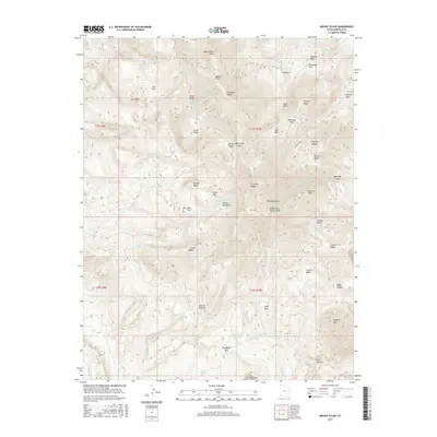
2017 Map of Mount Ellen
USGS Topo · Published 2017About this map
Mount Ellen Peak dominates this section of the Henry Mountains, a landscape defined by high-altitude ridges and isolated basins. The map illustrates a high-desert terrain where water sources like Birch Spring and McClellan Spring are critical landmarks. Human activity is evidenced by the winding path of Pistol Creek Rd and a designated route leading To Antenna on a high ridge. Historical land use in these elevations is suggested by named depressions and flats, including Bromide Basin and Sawmill Basin, alongside peaks named for early figures such as Kimble and Turner Peak. The network of drainages, from Pistol Creek to Granite Creek, carves through the distinct geology of the S Summit Ridge and Wickiup Ridge, providing a detailed record of the physical geography of Garfield County.
Find a feature on this map
66 named features on this map. Tap any name to fly to it.
Don’t see what you’re looking for? This feature index may not catch every label — zoom into the map to look around manually.
Map Details
Editions of this 2017 Mount Ellen Map
This is the sole edition of this map. No revisions or reprints were ever made.
Other maps of this area

1885 · San Rafael
USGS Topo · 1:250,000

1886 · Henry Mountains
USGS Topo · 1:250,000

1892 · Henry Mountains
USGS Topo · 1:250,000

1952 · Mount Ellen 4 SW
USGS Topo · 1:24,000

1952 · Mt Pennell 2 NE
USGS Topo · 1:24,000

1952 · Mt Hillers
USGS Topo · 1:62,500

1952 · Mt. Ellen 4 NW
USGS Topo · 1:24,000

1952 · Mt Pennell 1 NW
USGS Topo · 1:24,000

1952 · Bull Mountain
USGS Topo · 1:62,500

1953 · Mt Pennell
USGS Topo · 1:62,500