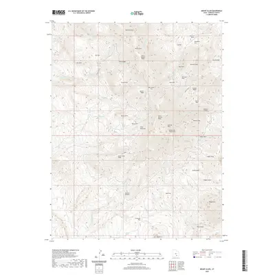
2020 Map of Mount Ellen
USGS Topo · Published 2020About this map
Mt Ellen Peak and the high ridges of the Henry Mountains dominate this high-elevation terrain in Garfield County. The landscape is defined by a complex network of drainage basins and peaks, including Kimble and Turner Peak and Bartons Peak. Remote water sources such as Copper Basin Spring, Airplane Spring, and McClellan Spring suggest the importance of these isolated points for surveyors and travelers in the high desert.
Find a feature on this map
63 named features on this map. Tap any name to fly to it.
Don’t see what you’re looking for? This feature index may not catch every label — zoom into the map to look around manually.
Map Details
Editions of this 2020 Mount Ellen Map
This is the sole edition of this map. No revisions or reprints were ever made.
Other maps of this area

1885 · San Rafael
USGS Topo · 1:250,000

1886 · Henry Mountains
USGS Topo · 1:250,000

1892 · Henry Mountains
USGS Topo · 1:250,000

1952 · Mount Ellen 4 SW
USGS Topo · 1:24,000

1952 · Mt Pennell 2 NE
USGS Topo · 1:24,000

1952 · Mt Hillers
USGS Topo · 1:62,500

1952 · Mt. Ellen 4 NW
USGS Topo · 1:24,000

1952 · Mt Pennell 1 NW
USGS Topo · 1:24,000

1952 · Bull Mountain
USGS Topo · 1:62,500

1953 · Mt Pennell
USGS Topo · 1:62,500